When those temperatures rise, we often find ourselves searching for relatively easy trails that we can finish quickly but still have a great payoff. The Wilson Canyon Trail is one of our favorite hikes that fits that bill. This hike is perfect for a warm day, when you’re short on time or for those hiking with young children in tow. Be sure to hike this trail early in the morning, in the evening or in the middle of the week because it begins at one of the most popular stops in Oak Creek Canyon, Midgley Bridge. Otherwise, parking might pose a bigger challenge than the hike.
The 3-mile out-and-back Wilson Canyon Trail is a relatively easy stroll with magnificent views at the end that’s perfect for hikers with young children and on days when you’re not up for a long, challenging hike.
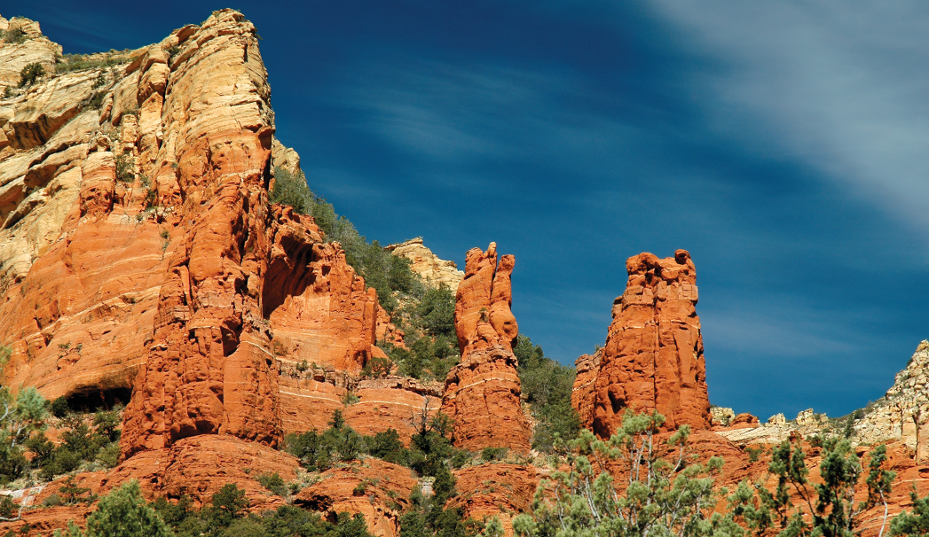
From the trailhead, begin hiking north with Midgely Bridge behind you. Almost immediately after you start hiking, you’ll see the Wilson’s Canyon View Point on your left. Be sure to pause here. Take in views of the stunning canyon and Sedona’s red rocks. After that, the trail quickly forks – follow the cairns and veer right. At the beginning of the hike, telephone wires obscure your views, but you will quickly pass under the wires and enter shallow Wilson Canyon, with the sounds of AZ-89A disappearing behind you as you follow the path of an old highway. After hiking for a little less than a half-mile, you’ll cross a shallow stream. During our hike, there was a trickle of water and some small pools in this area. You will cross the streambed numerous times along your hike, but for the vast majority of the year, the streambed is dry. You will reach the junction of Wilson Canyon and Jim Thompson trails after you’ve hiked .71 mile. Make a slight right to continue into Wilson Canyon. You are now hiking in Red Rock-Secret Mountain Wilderness. It’s wooded and shaded in this area with towering red rock walls on either side. The plentiful shade makes this an ideal warm-weather hike. It’s also a chance to get away and truly immerse yourself in nature. We heard woodpeckers and buzzing bees on our hike and little else.
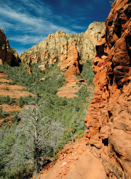
The trail officially ends 1.4 miles from the trailhead, but don’t turn around just yet. If you end here, you miss the best views. Walk a couple of hundred feet beyond the end-of-trail sign, and look for a pathway on the right. Climb up the rocks – the hardest part of the trail that’s so worth it – and you’ll be treated to one-of-a-kind views of the red rock cliffs and spires at the back of this box canyon. You’ll also have a 360-degree view from this vantage point. Look for the lava-encrusted top of Wilson Mountain and the backside of Schnebly Hill. Blooming manzanitas give off a honey-like fragrance, and natural outcroppings offer plenty of places to sit and take in those breathtaking views. Even after exploring this area, we had only hiked 1.5 miles from the car. Climb down and return the way you came for an easy, serene 3-mile round-trip hike.
Please check with the Red Rock Ranger District of Coconino National Forest before planning your hike. For more information visit: https://www.fs.usda.gov/recarea/coconino/recarea/?recid=54892