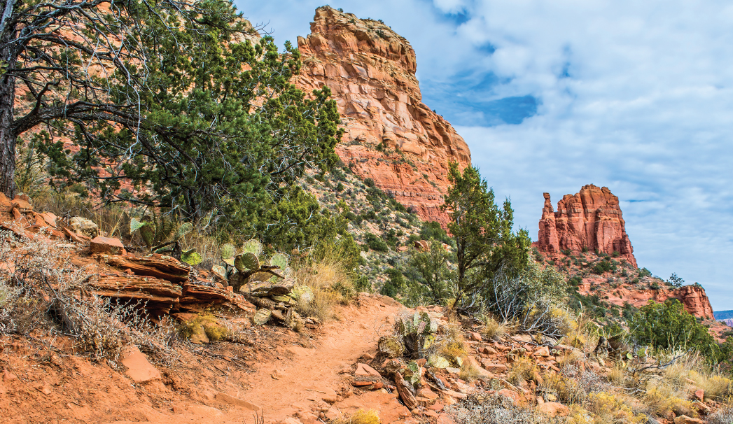
Thunder Mountain Trail is a gem of a hike that meanders along the base of its namesake, also known as Capitol Butte or Grey Mountain. These trails in West Sedona are some of our favorites, especially if we’re looking for a quieter hike. There doesn’t tend to be as much foot traffic on them, and the red rock vistas are stellar. Though there isn’t a ton of shade along the trail, it’s a short, easy jaunt with trailheads on both ends, which makes it a four-season hike. It’s a 4-mile round-trip, or you can leave a car at each trailhead and turn it into an easy 2-mile walk. If that’s the case, we recommend starting your hike at the Sugarloaf Trailhead on Buena Vista Drive because it’s a downhill journey in that direction. From the Buena Vista trailhead, the hike begins on Teacup Trail, which heads straight toward towering Thunder Mountain, the monolith that dominates all of West Sedona. You’ll hike Teacup for 0.34 mile before you come to the intersection of Teacup and Thunder Mountain trails. Turn left on Thunder Mountain.
Red rock formations on the loop trail. The Thunder Mountain Trail circles the base of its namesake, Thunder Mountain or Capitol Butte. The Native Americans called it Thunder Mountain due to the fact that it can be struck by lightning up to 4,000 times a year.
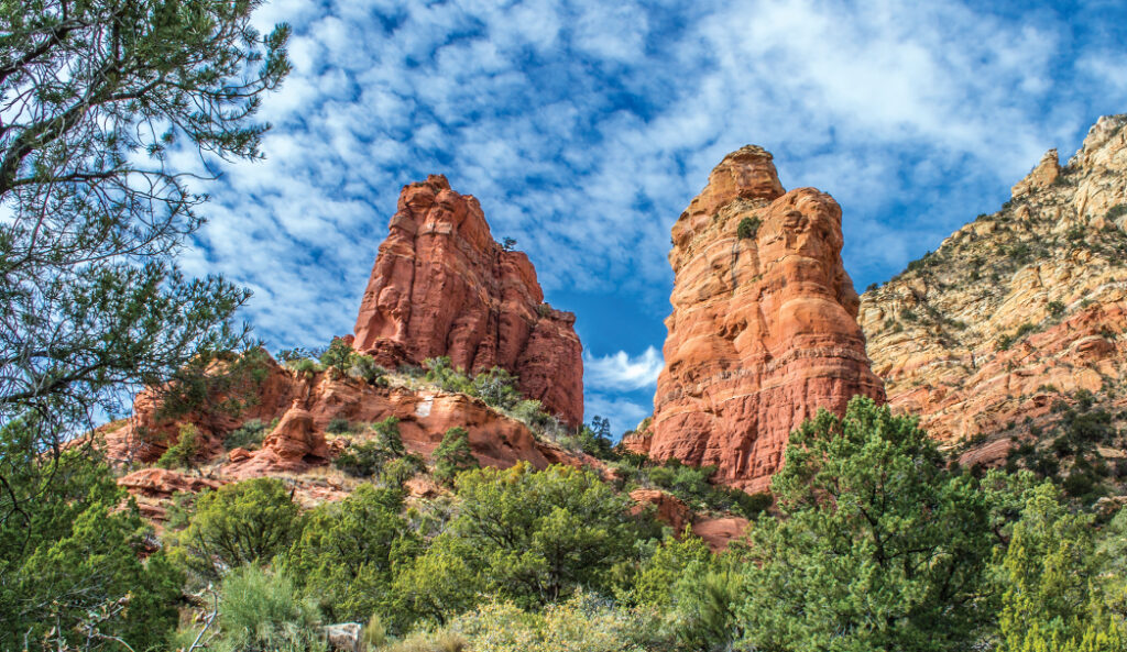
For the remainder of the hike, you’ll be marching southwest with Thunder Mountain to your right and Coffee Pot Rock behind you. Chimney Rock, which is all called Three Fingers since it resembles, well, three fingers, is directly in front of you. This hike offers up stellar views of that spire. This is as close as you can get to Thunder Mountain without climbing it, and the up-close-and-personal views will impress everyone in your party. The trail makes its way through the usual Sedona vegetation: juniper trees, prickly pear cactus, Mormon tea shrubs and yucca plants. After it rains, you’ll likely spot tiny wildflowers. Thunder Mountain Trail intersects with Andante Trail 0.58 miles into the hike and then Lower Chimney Rock Loop 1.34 miles from the trailhead. Just before the Lower Chimney Rock junction there’s a short trail off to the left that leads to Amitabha Stupa and Peace Park, a favorite local meditation spot. If you have time, it’s worth a visit to check out this spiritual place that features a stupa or Buddhist shrine. If you’re up for even more and have time, consider taking Lower Chimney Rock to the Summit Trail. After a short, but steep hike, you’ll enjoy 360 degree views of West Sedona that makes this detour totally worth it. Thunder Mountain Trail ends at a trailhead on Thunder Mountain Road, roughly 1.98 miles from the Sugar Loaf Trailhead. If you return the way you came, you will have a couple of short hills to navigate, so keep that in mind when planning your day.
Please check with the Red Rock Ranger District of Coconino National Forest before planning your hike. For more information visit: https://www.fs.usda.gov/recarea/coconino/recarea/?recid=54892