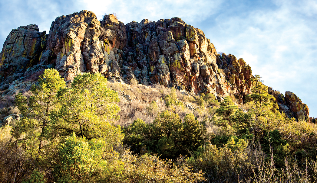
The Thumb Butte Trail is one of the most popular trails in Prescott National Forest for very good reasons. For starters, it’s easy to reach. The trailhead is a mere 10 minute drive from downtown Prescott. The hike features stunning views of the city and area’s surrounding mountains and is named after one of Prescott’s most prominent landmarks that resembles, you guessed it, a thumb. The thumb sits at an elevation of about 6,415 feet and offers up stellar views of the entire region. Keep in mind that the trail is relatively steep and gains just less than 700 feet in elevation. Leashed dogs are welcomed on the trail. We love how beginner friendly this hike is.
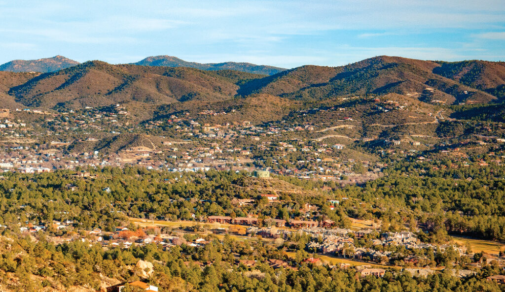
A view of homes and buildings in Prescott as seen from the Thumb Butte Trail, one of the most popular trails in the area.
The trail features safety rails and plenty of places where you can rest on the trek up. Nature signs are also posted. See if you can spot the prickly pear cactus and alligator junipers that line the trail. A word of caution: during the winter months, it’s typically too icy to hike unless you have spikes. Shortly after leaving the trailhead, the hike quickly hits a fork. The steeper part is the to left. This part is paved but ascends relatively quickly. Although it’s dirt, the right is easier as it’s a more gradual ascent. We choose to hang a right and then headed counter clockwise on the trail. We love the fact that you’re surrounded by towering ponderosa pine trees almost immediately. As you continue on, you’ll noticed benches where you can rest and take in the views. At about 1.1 miles, the trail forks. Stay left. After this, you’ll notice a memorial to the 19 Granite Mountain Hotshots or wildland firefighters who tragically perished in the Yarnell Hill Fire in 2013.
Once you reach the Groom Creek Vista near the summit, enjoy the spectacular vistas. You can see views of Prescott, the Bradshaw Mountains, Sierra Prieta Mountains, Granite Mountain and the Mingus Mountain. It’s a site to behold and one we’ll never tire of. On really clear days, you can sometimes even see the San Francisco Peaks in Flagstaff. Please note that peregrine falcons like to nest on the basalt crags of Thumb Butte during certain times of the year. Parts of the trail – typically the summit – may be closed to protect their nests. Be sure to observe the signs and keep away from the nests. Come back down on a paved trail for a steep descent with plenty of switchbacks until you reach the parking lot. The entire trail clocks in at just over 2 miles long.
Please check with the Bradshaw Ranger District of Prescott National Forest before planning your hike. For more information visit: https://www.fs.usda.gov/detail/prescott/about-forest/districts/?cid=fswdev3_009842