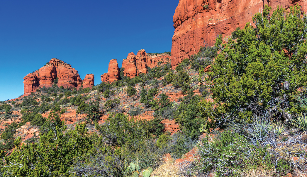
Sometimes when you’re out hiking, you’re searching for a real challenge. A hike that tests your physical and mental limits and offers a great payoff. Bear Mountain is one of those hikes that fits that description to a “T.” The trail that leads up Bear Mountain may only be just over 2.3 miles one way, but it’s easily one of the most difficult hikes in Sedona. There’s little to no shade, so if hiking this trail is on your bucket list, the cooler months are the time to do it. Be up for a true challenge. The trail begins across Boynton Pass Road from the Bear Mountain and Doe Mountain parking lot. You’ll first hike across flat, cactus-studded terrain, but don’t let that fool you – things are going to get much harder soon. You’ll come upon a hiker’s register at roughly 0.12 miles into the hike, and you’ll start gaining elevation 0.3 miles from the trailhead. The Bear Mountain Trail climbs more than 2,000 feet in about 2 miles.
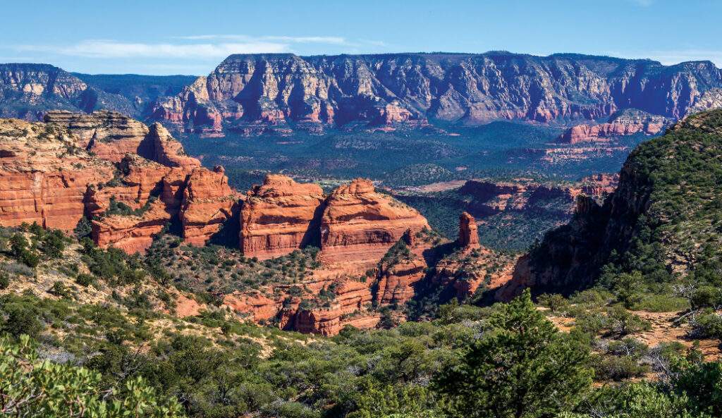
The hike to the summit of Bear Mountain is strenuous, but rewarding. Hikers can look forward to sweeping red rock views like the one pictured above. The Forest Service advises that this hike will likely take over 4 hours.
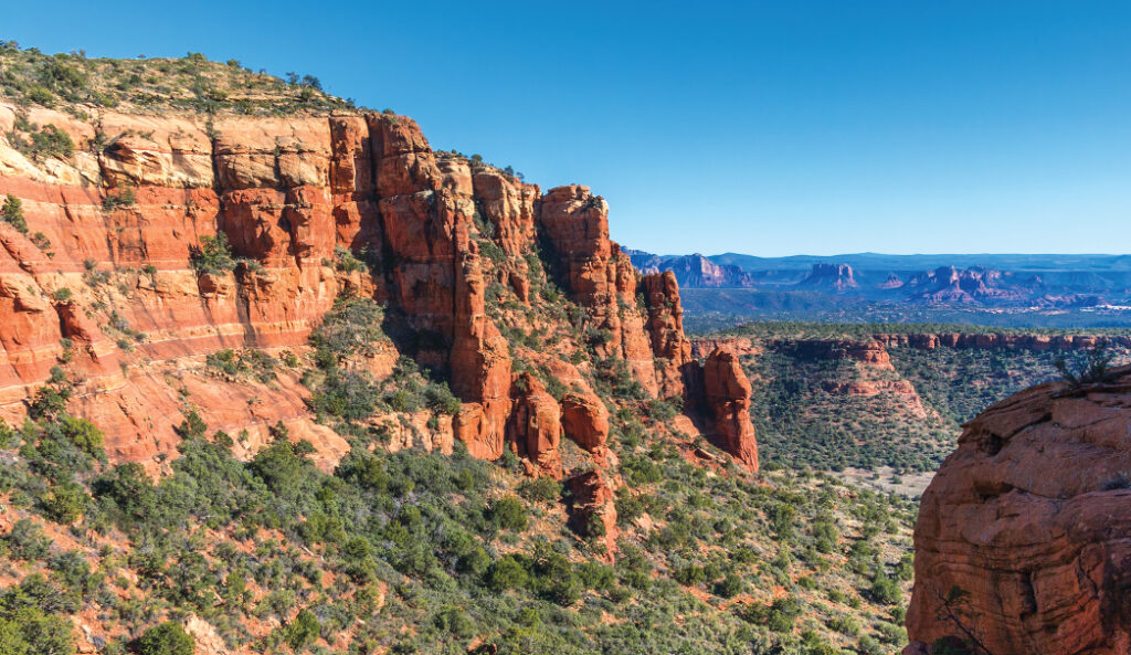
We enjoy this first climb the most because the rocky and steep trail hugs the side of a red rock cliff. It gives you the chance to get up close to an interesting rock face riddled with holes from water and wind erosion. Because this section is so steep, watch your footing. Less than a half-mile into your hike, you’ll reach a secluded alcove. Pause and look behind you for views of Capitol Butte and the edge of the Seven Canyons area. From the alcove, turn left and continue to climb over boulders and loose rock. After about 0.75 mile, you’ll be able to see the top of Courthouse Butte, the spire of Chimney Rock and the expanse of the Verde Valley. Follow the white diamonds all along the trail. The views continue to improve the higher you climb. The trail winds its way into a small canyon before making one last steep push and then leveling out for a while. Look in front of you, and you’ll see another mountain in the distance. Its summit is your final destination. Many hikers choose to end their hike here, about 1.25 miles from the trailhead.
A scene from Bear Mountain, one of Sedona’s toughest hikes.
If you decide to continue on, you’ll meander through a landscape of prickly pear cactus and juniper trees with beautiful views of Fay Canyon toward the northeast. About 2 miles from where you started your hike, the trail makes another heart-pounding climb. When you do reach the top, your views extend all the way to the San Francisco Peaks and Red Canyon. It’s definitely worth the effort. Thankfully, one you’ve hit the top, it’s all downhill from there.
Please check with the Red Rock Ranger District of Coconino National Forest before planning your hike. For more information visit: https://www.fs.usda.gov/recarea/coconino/recarea/?recid=54892