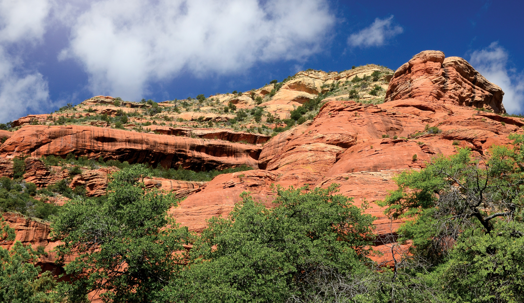
One of our favorite things about trails is that they can offer a choose your own adventure style journey. Loy Canyon is one of the city’s trails that delivers both an extremely difficult challenge or a relatively easy stroll in the woods, depending on how long you stay on the trail for. Sometimes, especially when it’s warm outside, you just want to walk in the woods, Hansel-and-Gretel style. That’s when you need to explore Loy Canyon and Loy Canyon Trail. The trail meanders along the floor of the canyon for 4 relatively flat miles before it climbs to the top of the Mogollon Rim (gaining 1,000 feet in just one mile). There’s no need to make the climb, especially when it’s hot. Instead, spend a few hours in a shaded forest surrounded by wildflowers, buzzing carpenter bees and tall pine trees. Trust us, it’s good for the soul. Loy Canyon Trail was used in the 1880s by the Samuel Loy family to move cattle from the rim to Sedona, according to a plaque at the trailhead. The trail starts off by hugging the fence line of Hancock Ranch, land that was purchased by the Trust for Public Lands and donated to the Forest Service back in 2004.
The first 4 miles of West Sedona’s Loy Canyon Trail offer a relatively easy and shaded stroll on the floor of the canyon – making it an ideal warm-weather trek. The Loy Canyon Trail is a former cattle trail.
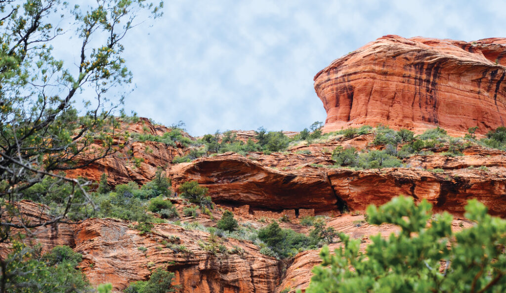
At the beginning of the hike, you’ll enjoy views of Loy Butte, a knobby red rock monolith on your left. The trail crosses a dry wash several times. After hiking 1.64 miles and crossing the wash, look left for great views of another butte with its spires and seemingly balanced rocks. Be sure to pause and listen when you’re hiking as you’re likely to hear birds singing. This is one of the rare area trails where you can find some solitude. When you’ve hiked 1.96 miles from the trailhead, you’ll come to a fork – turn right. At this point, the red rock views become fewer and far between, and instead it’s about a dense forest, the floor littered with dead leaves and pinecones. The trees supply plenty of shade that makes this hike doable even on the most sweltering days. Though the trail remains flat, it is sandy in many spots, making it slow going at times. We hiked until the trail began to climb, and then warm temperatures told us it was time to turn back. On the way out, after we had been hiking 4.75 miles, we spied Native American ruins halfway up Loy Butte (now on our right). For some reason, we didn’t spot the ruins on our way into the canyon, but a keen eye will locate them immediately. Enjoy the views, and then return to your car for a roughly 6-mile round-trip walk that’s accessible to all hikers, regardless of experience.
Please check with the Red Rock Ranger District of Coconino National Forest before planning your hike. For more information visit: https://www.fs.usda.gov/recarea/coconino/recarea/?recid=54892