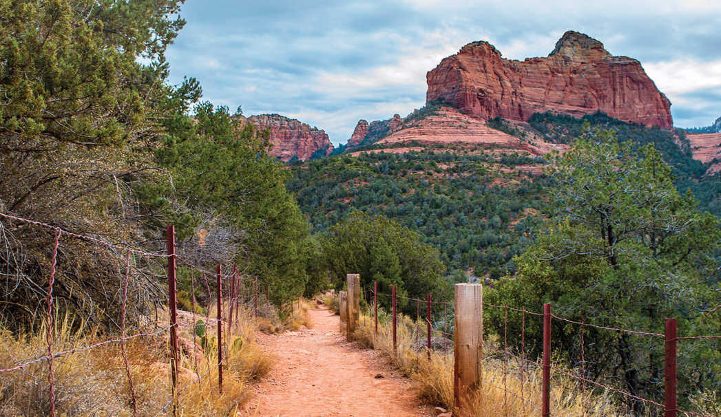
Huckaby Trail is a favorite hike among locals and tourists alike, and it’s not hard to see why. This Oak Creek Canyon trail offers up views of Sedona’s red rocks and lets you cross one of the city’s other cherished places: Oak Creek. When it’s hot outside, consider taking a dip in the creek to cool off. If Oak Creek is flowing strongly, be sure to not to cross it as it’s too dangerous. But no matter what time of year you hike, be sure to cover up and wear sunscreen. There’s little to no shade along this path. Originally constructed in 1998, the trail was rerouted sometime in 2013 to help deal with all the hiking traffic. Though we usually start at the Midgley Bridge Trailhead, we decided to mix it up and start the hike at the trailhead on Schnebly Hill Road. Huckaby Trail quickly descends into a dry wash through a series of switchbacks, and then just as quickly climbs back out of it. As you ascend, look to your left for stellar views of Snoopy Rock. During our hike, wildflowers were blooming along the trail. Dogs are welcome on the trail, and we spotted a few of them as we hiked. We reached the rerouted section shortly after the climb leveled out; 0.72 mile from the trailhead, you’ll find a bench at a new vista where you can sit and take in views of Uptown Sedona and Oak Creek.
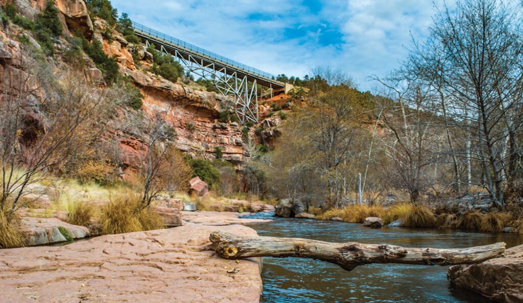
The Midgley Bridge as seen from the Huckaby Trail. You also can start this hike from this noteworthy site. The trail passes nearly underneath this bridge and concludes at the Midgley Bridge parking lot.
Not too far from the bench, the trail merges with the old path, and soon it parallels AZ-89A through Oak Creek Canyon. Before descending into the canyon, you’ll see Steamboat Rock on your left. Wilson Mountain, the tallest peak in Sedona at 7,122 feet, towers above Steamboat Rock. About 2 miles into the hike, you’ll reach the floor of Oak Creek Canyon. Continue walking, and you’ll find yourself practically underneath impressive Midgley Bridge. You’re walking along Oak Creek now. At this time of the year, keep an eye out for ripe blackberries. During the warmer months, quaint beaches tempt you to take a quick dip in the cool water. The trail crosses the creek twice and then makes a steep climb up to the bridge. We like to leave a second car at the bridge or at nearby Grasshopper Point. There’s a short (0.3-mile) trail that connects Huckaby with the Grasshopper Point parking lot (you’ll see the trail on your right, 3 miles from the start of your hike). Grasshopper Point Day Use Area features one of the best swimming holes in Oak Creek Canyon. A one-way hike from Schnebly Hill Road to Grasshopper Point is 3.6 miles. Hiking to the Midgley Bridge Trailhead is a little more than 3 miles, one way.
Please check with the Red Rock Ranger District of Coconino National Forest before planning your hike. For more information visit: https://www.fs.usda.gov/recarea/coconino/recarea/?recid=54892