If you don’t mind a bumpy ride to get there, Cow Pies Trail is probably one of the flattest and easiest hikes in Sedona. It also happens to be located in an area of Red Rock Country that saw a lot of action during Sedona’s movie heyday. The Cow Pies are visible in “The Last of the Duanes” (1930), “Leave Her to Heaven” (1945), “Angel and the Badman” (1947), “The Strawberry Roan” (1948), “Broken Arrow” (1950), “The Last Wagon” (1956) and the Elvis Presley film “Stay Away, Joe” (1968), among others. Located off Schnebly Hill Road, the formation, which does indeed resemble its namesake, especially when viewed from above, sits in Bear Wallow Canyon. The slick-rock mounds, or cow pies, offer beautiful views of the Mogollon Rim to the east and all the way to Mingus Mountain and Jerome to the west.
The easy Cow Pies Trail connects the Munds Wagon and the Hangover trails and also features stunning red rock views. This Sedona trail is also the site of a supposed vortex.
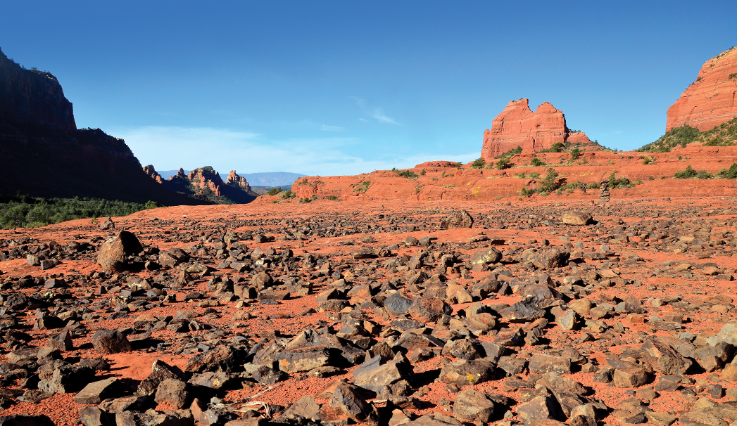
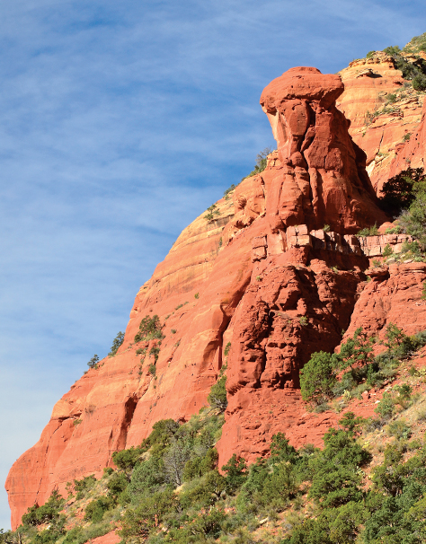
Drive east on unpaved Schnebly Hill Road for 3.5 miles and park in the parking area on your right. Cow Pies Trail begins directly across the road from the parking area. Schnebly Hill Road has become pretty rough over the past few years, making it impassable for anything other than high-clearance, four-wheel-drive vehicles. Don’t even think about taking a passenger car up it. The trail meanders through a forest of juniper and pinyon pines for only 0.13 mile before you reach the first cow pie. This area always makes us think of Mars. The slick rock here is red and barren with the exception of black lava rocks and craggy boulders that are strewn about, making for fantastic photos. Some will allege that this area is home to a vortex or an energy center. Whether you believe in that or not, you can’t deny that the views from here are stunning. Be sure to admire Mitten Ridge as the rock formation rises up in the background.
Continue on the trail, which alternates between crossing the cow pies and skirting its edges, traversing tall grasses and agave plants. The route is lovely, but it’s just as much fun to venture off-trail and explore the cow pies, looking for lizards and reflective pools of water. If you can, try exploring this area following a rain storm for a better shot of seeing the water. The area feels otherworldly and is a fun place to explore. It’s hard to get lost in this area – just keep an eye out for the white trail markers painted on the rocks. The trail officially ends when it intersects with Hangover Trail, about 0.6 mile from the parking area (if you roam off-trail, plan on 1.5-to-3 miles round trip). It’s an easy, family-friendly jaunt, and it gives you the opportunity to see the landscape that gave movie location scouts visions of dollar signs many moons ago.
Please check with the Red Rock Ranger District of Coconino National Forest before planning your hike. For more information visit: https://www.fs.usda.gov/recarea/coconino/recarea/?recid=54892