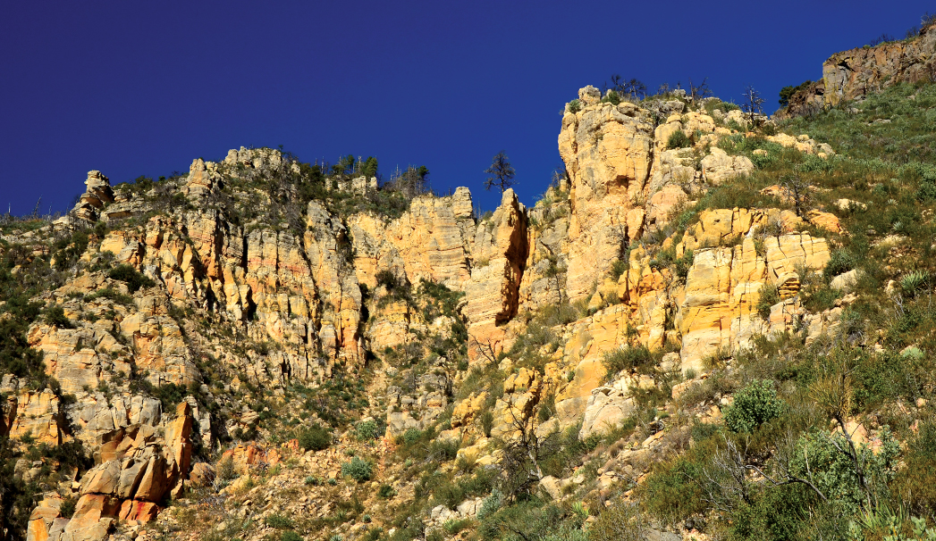
This time of year is our absolute favorite for hiking. The cool temperatures mean you can spend hours on the trails. In the winter months on the weekends, you’ll often find us taking long, meandering hikes. One of the top hiking trails in town is the A.B Young Trail. When we first hiked this trail back in 2017, we stopped our hike where the switchbacks end at the top of the Mogollon Rim. But on subsequent visits, we’ve followed the trail all the way to its end for a rewarding 8-mile round-trip hike. The A.B. Young Trail is the only route (of which we know) that climbs the west wall of Oak Creek Canyon. From AZ-89A in the northern reaches of the canyon, you can spot the trail, which seems to zigzag endlessly – and vertically – up the canyon wall. The trail climbs more than 1,600 feet in about 1.7 miles, and there’s no doubting its difficulty. (Crossing the creek at the beginning of the hike is equally as challenging.) Your reward: bird’s-eye views of Oak Creek Canyon and Sedona along with a couple of historical sites along the way.
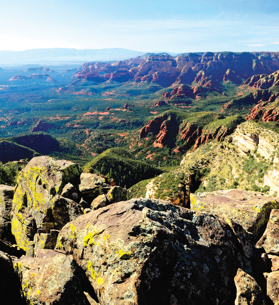
The 8-mile out-and-back and challenging A.B. Young Trail offers sweeping views of Sedona’s red rocks. This Oak Creek Canyon trail climbs 1,600 feet in 1.6 miles.
The trail begins at the Bootlegger Picnic Area. After you park, walk down a set of stairs, and you’re standing at Oak Creek. The trail actually begins on the other side of the creek, thus the rub. There’s no official creek crossing, so you’ll have to boulder hop to the other side. Once there, ignore the trail that parallels the creek, and look for the metal A.B. Young trail marker. According to the Coconino National Forest, the trail was originally built in the 1880s and then reconstructed by the Civilian Conservation Corps under the supervision of A.B. Young in the 1930s. The trail was also closed for many months after the Slide Fire struck Oak Creek Canyon in 2014. You’ll still see reminders of the fire along your hike.
The trail immediately begins to climb and remains steep throughout. The Forest Service reports 33 switchbacks, but we lost count. Once you reach the top, you’re treated to a top-of-the-world sensation, and views of pine-studded canyons and the orchards of Slide Rock State Park. The trail levels out up here, and we continued hiking to East Pocket Fire Lookout, though the tower was closed when we hiked. East Pocket Tank is a large watering tank for cattle that provides plenty of Instagram opportunities. Four miles from your car, the trail abruptly ends at a cliff that overlooks the Seven Canyons region. It’s here that you’ll find the remains of Gerard and Sylvia Vultee’s plane. The aviators died in a plane crash in 1938 (nearby Vultee Arch is named in their honor). You’ll also see crosses marking the couple’s gravesite. We paid our respects and marveled at the views before heading back the way we came for an 8-mile hike.
Please check with the Red Rock Ranger District of Coconino National Forest before planning your hike. For more information visit: https://www.fs.usda.gov/recarea/coconino/recarea/?recid=54892