When it’s hot outside, but we still want to hike, we love trails where you can leave a car at either end, and the Jim Thompson Trail is a great option. The hike begins near Jordan Road in Uptown and ends at Midgley Bridge in Oak Creek Canyon. Jim Thompson, the trail’s namesake and the first European settler in Oak Creek Canyon, built the trail in 1887 to connect his homes in Oak Creek Canyon and Sedona.
Begin your hike along Park Ridge Drive. You can access the trail from a trailhead along the side of the road or at the official trailhead in the parking lot at the end of the road. The latter part of Park Ridge Drive isn’t paved and it can be bumpy, so we chose to begin our hike at the beginning of the dirt road rather than drive a half-mile to the trailhead. Look for the Jim Thompson trail sign on the right, a couple of hundred yards after the pavement ends, and park on the left.

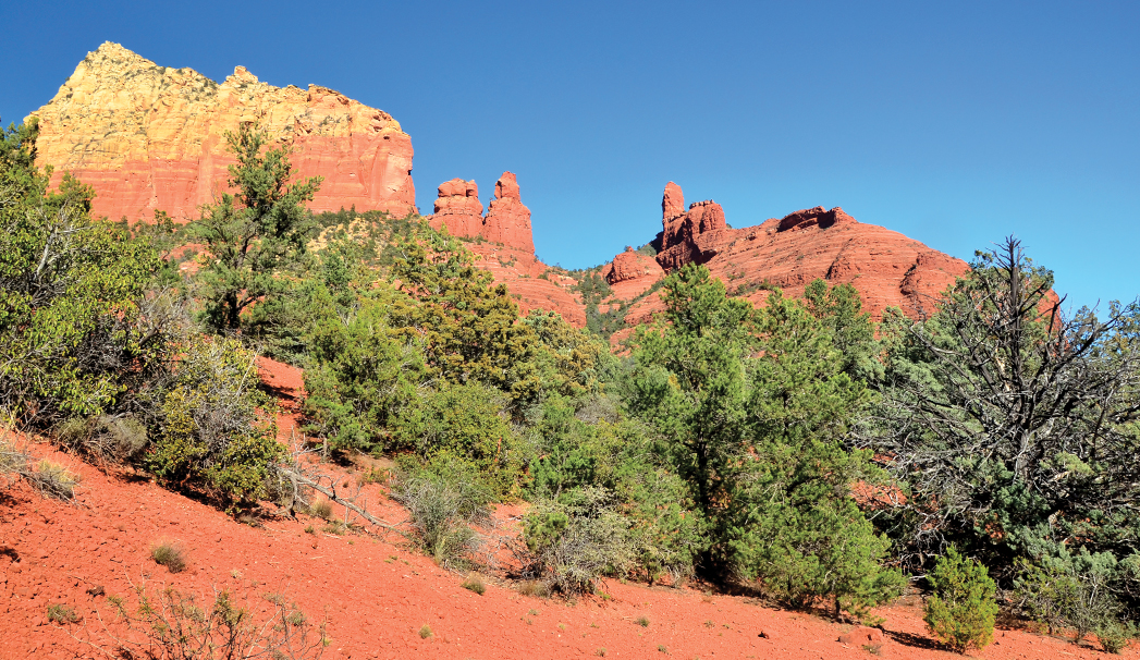
A close-up shot of a red rock formation that you can see from this trail. The Jim Thompson Trail is a little over 3 miles one way and about 5 miles out and back. Named after the first European settler in Oak Creek, the trail was first constructed in 1887 and offers a variety of views. Being a mostly flat trail, it’s a relatively easy hike. You also might see horseback riders and mountain bikers on this trail.
The hike makes a steady climb almost immediately. After walking 0.16 mile, you’ll come to a fork in the road – stay straight. The trail narrows and is surrounded by tall evergreens, which provide welcome shade – making it an ideal option in the warm summer months. The path can be rocky in certain places. Be sure to watch your step. You’ll catch glimpses of jagged rock formations between the boughs of the trees. Pass through a metal gate 0.44 mile into your hike, and the views begin to open up. Jim Thompson Trail is known for its jaw-dropping vistas of Steamboat Rock, which you begin to see after passing through the gate. Soon you are surrounded by towering red rock cliffs that almost make it feel like you’re in an amphitheater. Cross a streambed after hiking 1.18 miles (during our spring hike it was dry with the exception of a few puddles) and walk underneath a set of power lines after 1.6 miles. From here, the trail makes a steady descent into Wilson Canyon. Look behind you for views of Uptown, especially if you aren’t returning the way you came.
Jim Thompson Trail ends at the junction of Wilson Canyon and Wilson Mountain trails, 2.68 miles from your car. Turn right on Wilson Canyon Trail (turning left takes you into the picturesque box canyon) and head toward the parking lot at Midgley Bridge. You’ll reach your second car 3.25 miles from where you left your first one. If you have time and it’s not too hot, you can simply turn around for an out-and-back hike that’s about 5 miles.
Please check with the Red Rock Ranger District of Coconino National Forest before planning your hike. For more information visit: https://www.fs.usda.gov/recarea/coconino/recarea/?recid=54892