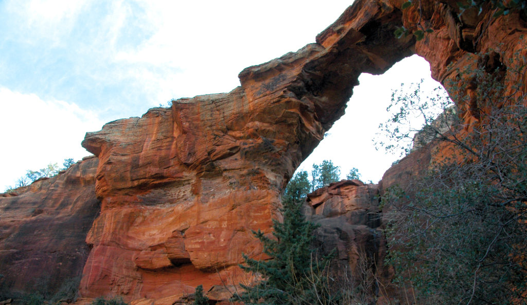
The sandstone arch that gives this trail its name has become a star on social media. The arch’s visual appeal is undeniable. Many hikers flock here to see this incredible arch with their own eyes, and it’s easy to see why they return. The short, 0.9-mile trail that leads to the top of the arch is absolutely divine and not nearly as scary as its name implies. Hike out early to avoid the crowds.
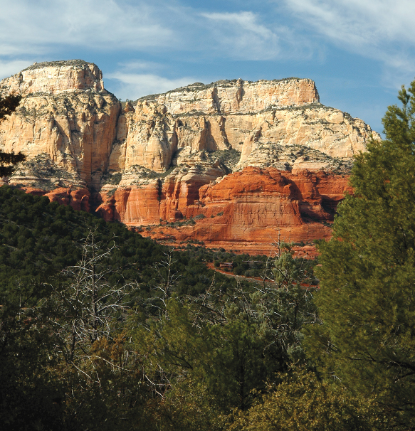
Soak up the red rock views if you hike this trail.
When you start hiking to Devil’s Bridge, you get the feeling you’re hiking into a canyon because the red rock cliffs tower above you, but you’re not. The trail climbs gently in the beginning with broom snakeweed, juniper trees, manzanita bushes, prickly pear cactuses and banana yuccas growing on either side. After hiking 0.41 mile, you’ll reach a trail registry on your right. Make sure you sign in. Look across from the registry at the cliffs. The black patina, or “desert varnish,” on the red rocks is mineral (manganese oxides, iron and silica) deposits.
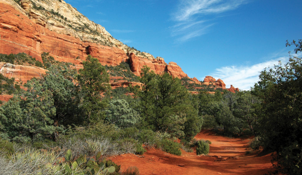
Enjoy classic Sedona hiking scenery like trees, red rocks and blue skies on this trail.
About a half-mile into your hike, the trail begins to climb more steeply, and it becomes rocky. At 0.68 mile, the route narrows dramatically. You’ll reach a fork in the trail 0.71 mile from the trailhead – stay to the left. Walk another couple hundred feet and then climb up the rock staircase on your right. The staircase levels out on a rock shelf that offers amazing views of the Seven Canyons area. Keep hiking, duck under a tree at 0.84 mile, and suddenly the bridge appears parallel to you on the left.
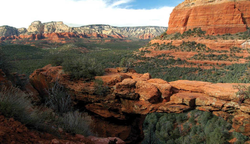
A short side trail will give you this view. Don’t miss it.
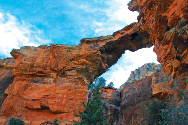
The trail continues out onto the bridge, though a sign at the trailhead posted by the Forest Service warns against walking across the bridge due to the inherent instability of sandstone arches. Proceed with caution and at your own risk. Walk back down the staircase and instead of turning left to head back to your car, turn right and follow the short path that leads to the base of the arch. You’ll have to scramble over some boulders, but you’re rewarded with a view of the bridge’s underside, 50 feet above you. It’s all downhill back to the trailhead, and our entire hike clocked in at 1.89 miles round trip. Add 2.6 miles to that total if you walk in from the road.
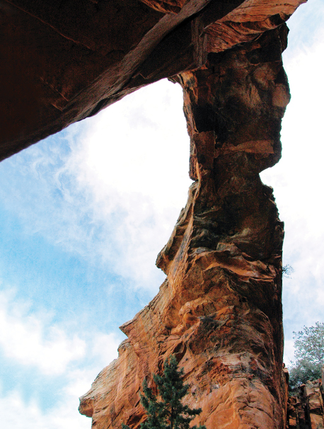
A unique view from underneath the Devil’s Bridge sandstone arch – the largest one in the Sedona area.
Please check with the Red Rock Ranger District of Coconino National Forest before planning your hike. For more information visit: https://www.fs.usda.gov/recarea/coconino/recarea/?recid=54892