Named after a family of ranchers who herded cattle in this area, the Girdner Trail connects Yavapai College and the former Sedona Cultural Park with Dry Creek Road via 4.75 miles of interesting and diverse terrain. This trail is perfect for those looking for a long day hike (almost 10 miles round trip) or you can opt to park a car at both trailheads and take your time exploring the juniper forests and tributaries of Dry Creek. If there’s a dusting of snow on the ground, all the better.
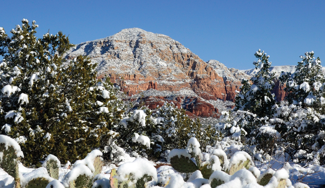
We began our hike at the trailhead located across from the former Sedona Cultural Park – the views from here are extraordinary. Looking north and west you’ll be treated to Cockscomb Butte, Casner Mountain, Mingus Mountain, Capitol Butte and the intricate layers of the Seven Canyons area.
The first 0.3 mile of the trail is relatively rocky yet flat. You’ll find a few rusted cans and broken bottles, a reminder that this area used to be the Sedona Dump (the Girdner trail was completed in 1999). The trail soon narrows and hugs the side of a hill with a steep drop into a canyon on your right. After about 1 mile, the trail begins to descend into the canyon – you reach the bottom at 1.2 miles. The trail soon leads you under power lines, and after 1.61 miles, it intersects with the Pipeline Trail. Stay on Girdner. You continue to remain in valleys and canyons. You’ll come across small red rock formations and boulders as you cross tributaries of Dry Creek – the tributaries could have water running depending on the weather. After 2.03 miles, you’ll walk through a gate and continue along the banks of Dry Creek, which can be a raging river during the monsoon season. You’ll cross Dry Creek for the last time 3 miles from the trailhead.
After crossing the creek, the trail climbs out of the canyon. The last 2 miles are less interesting and more strenuous; your initial feeling of isolation disappears, especially when you begin hearing the echoes of gunshots coming from the shooting range located off Dry Creek Road and the traffic from the same road. You’ll come across the Arizona Cypress Trail after hiking 3.56 miles, and at 3.71 miles, Two Fence Trail intersects Girdner. The last 0.75 mile of the trail rewards hikers with views similar to those at the beginning. You’re now near the heart of the Seven Canyons area with its towering red rock cliffs. Look to your right for a nice view of Chimney Rock, its lone spire standing out against the blue sky. Girdner ends at Dry Creek Road, just opposite FR 152/Vultee Arch Road.