With a name like Table Top, you can be fairly confident that the trail will offer spectacular views – and it does. But the route actually takes its name from Airport Mesa, which was originally Table Top Mesa before the Sedona Airport was built in 1957. This trail climbs the face of Airport Mesa and then ventures out onto a connecting knoll, offering views of the red rocks and planes taking off all at the same time.
Your hike begins on the Bandit Trail, which, oddly enough, starts at the back of a commercial center parking lot on Shelby Drive. The beginning of the trail is nothing to write home about; it skirts Sedona’s industrial area and has an urban feel. You will pass junctions for Old Post Trail and Ridge Trail before Bandit makes a steady climb up the mesa. The trail was named after a pet that was buried along the route, but the grave marker is long gone. Bandit merges with Airport Loop 0.55 mile from the parking lot – turn right and continue uphill. The fact that you will be hiking downhill at the end of your journey will make this section easier. The trail levels out after you’ve been hiking for almost one mile. Pause, catch your breath and enjoy bird’s-eye views of West Sedona on one side and Cathedral Rock on the other.
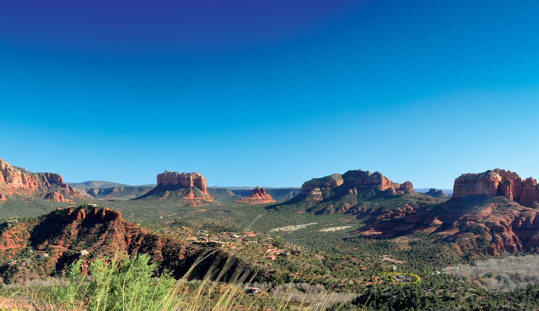
Continue along the trail until you reach the junction of Airport Loop and Table Top. Turn right on Table Top, which leads you along a narrow ridge covered in low-lying cactus and a few sparse junipers. During our hike, the wind was howling through this area. After walking for 1.22 miles, you’ll notice a social trail on your left. Ignore it and stay straight. The trail ends at the tip of the knoll, 1.61 miles from the trailhead. The fierce wind hissed through tall grasses at this point, but we still took the time to take in views of Cockscomb, Robbers Roost, the Chapel of the Holy Cross, the Nuns, Courthouse Butte, Bell Rock and Cathedral Rock. Far below you can make out the trees that line the banks of Oak Creek, cars along Red Rock Loop Road and the rooftops of the million-dollar homes in the Back ’O Beyond development. Hike back the way you came (downhill!) for a 3.2-mile round-trip hike that is rarely crowded but offers up big views.
MORE SEDONA HIKES: Hike of the Month archive, 10 favorite hikes, Sedona day hikes, Mt. Humphreys
SEDONA MOUNTAIN BIKING: Trail Masters