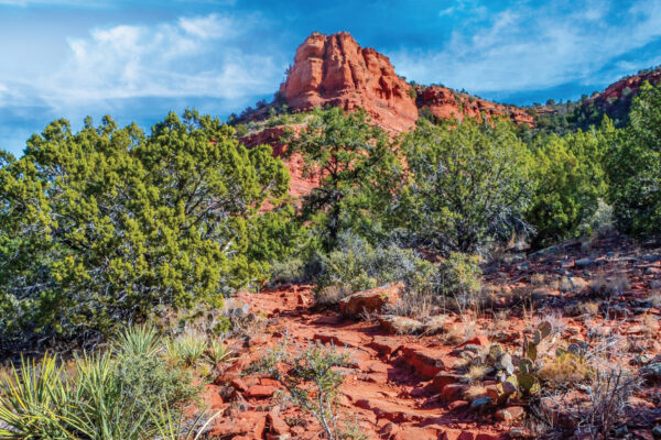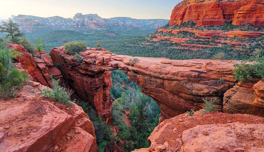
Devil’s Bridge is one of Sedona’s most iconic trails. This is largely due to the massive sandstone arch – the largest in the Sedona area – that gives this trail its name. Many hikers flock here to see this incredible arch with their own eyes, and it’s easy to see why they return. The short, 0.9-mile trail that leads to the top of the arch is absolutely divine and not nearly as scary as its name implies. Hike out early to avoid the crowds. Otherwise, you’ll likely have to wait in line to snap a picture of yourself on the bridge. About those crowds. The hardest part about this hike is dealing with the droves of people that flock here. Hike early to try to avoid all that. When you start hiking to Devil’s Bridge, you get the feeling you’re hiking into a canyon because the red rock cliffs tower above you, but you’re not. The trail climbs gently in the beginning with broom snakeweed, juniper trees, manzanita bushes, prickly pear cactuses and banana yuccas growing on either side. After hiking about 0.41 mile, look at the nearby cliffs. The black patina, or “desert varnish,” on the red rocks is mineral deposits.
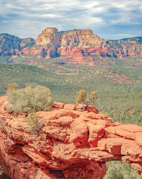
About a half-mile into your hike, the trail begins to climb more steeply, and it becomes rocky. At 0.68 mile, the route narrows dramatically. You’ll reach a fork in the trail 0.71 mile from the trailhead – stay to the left. Walk another couple hundred feet and then climb up the rock staircase on your right. The staircase levels out on a rock shelf that offers amazing views of the Seven Canyons area. Keep hiking, duck under a tree at 0.84 mile, and suddenly the bridge appears parallel to you on the left. The trail continues out onto the bridge. Proceed with caution and at your own risk. Walk back down the staircase and instead of turning left to head back to your car, turn right and follow the short path that leads to the base of the arch. You’ll have to scramble over some boulders, but you’re rewarded with a view of the bridge’s underside. It’s all downhill back to the trailhead, and our entire hike clocked in at 1.89 miles round trip. Add 2.6 miles to that total if you walk in from the road.
Please check with the Red Rock Ranger District before planning your hike. For more information visit: https://www.fs.usda.gov/r03/coconino