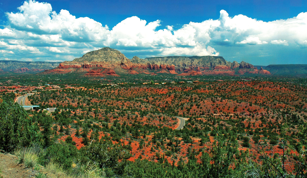
When those scorching summer temperatures arrive, we look for less strenuous hikes to get our nature fix. That’s why we turn to hikes that are short and sweet. And the Schuerman Mountain Trail more than works. This trail also offers some seclusion – a rarity these days. We only saw maybe one or two people on the trail when we hiked. Your journey kicks off just past Sedona Red Rock High School. The trail starts behind the building. Take a right at approximately mile .07, and then follow the fence. If you ever lose your bearings, follow the cairns – tall piles of rocks wrapped up in metal fence that mark the way. You’ll find a green gate that you’ll want to walk past at mile 0.15. The trail doesn’t offer much shade, but you’ll want to be sure to take a look behind you at the red rock views including Coffee Pot, Chimney Rock and Capitol Butte all around when it does. Mind your footing. The trail can be rocky. It’s mostly a steady climb uphill that gradually curves up the mountain with a few flat breaks throughout. It’s worth noting that the soil in some places is that classic deep Sedona red. In some spots, it’s so vibrant it’s almost orange.
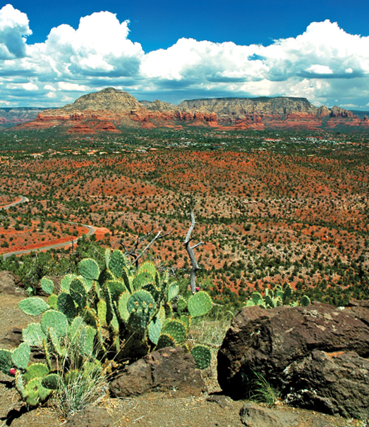
West Sedona’s Schuerman Mountain Trail is a short and steep jaunt that serves up red rock views. The trail is roughly 2 miles out-and-back. This is also a great trail to tackle during the spring when the flowers are in bloom.
The last time we hiked this trail, the wildflowers were in bloom. We especially loved seeing the bright pink flowers on the prickly pear cactus. Follow the trail until it veers off to the left. You can turn right here, but we find this part of the trail to be somewhat drab and don’t recommend it unless you’re trying to add some extra miles to your hiking trip. You’ll know you’ve hit the summit when you see a wooden sign marking the surrounding trails, and the trail flattens out. Once you’re at the top at 4,450 feet, it’s a pick-your-own adventure. You can choose to continue on the Schuerman Mountain Trail, turn back or continue hiking on the 0.33-mile-long Schuerman Mountain Vista Trail. We’d recommend the Vista that branches off to the left. It starts off with not much of a view, but eventually, you’ll find a flat vista where you can take in red rocks views all around. The Vista trail kicks off with a small hill but then flattens out to a gravel path, which feels nice underneath your feet after the rather rocky incline. Return the way you came for a hike that’s just less than 2 miles.
Please check with the Red Rock Ranger District of Coconino National Forest before planning your hike. For more information visit: https://www.fs.usda.gov/recarea/coconino/recarea/?recid=54892