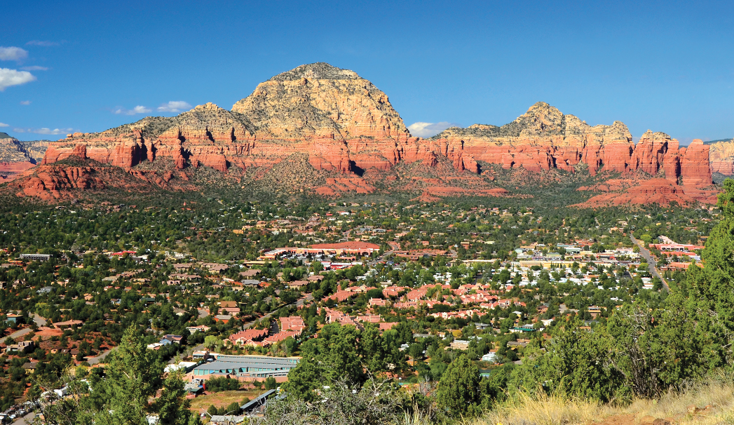
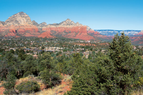
Airport Loop
When out-of-town guests who don’t hike often ask us what trail to hike, Airport Loop is typically our answer. This relatively flat (but a little rocky) trail offers breathtaking views of all of Sedona’s major red rock formations and is ideal for beginners. Plus, there’s a vortex nearby. But even the most experienced hikers will fall for this breathtaking 3.3-mile loop trail that circles Airport Mesa. The hike starts just past the parking lot. From the saddle, turn right and then make a left to follow the trail. The trail is relatively narrow and hugs the edge of the mesa – meaning you’ll have to hike single file if you’re in a group. You’ll quickly spot Courthouse Butte and Bell Rock. At 1.6 miles, Airport Loop intersects with Table Top trail. Veer right here. Eventually, you’ll come across a unique vantage point of Cathedral Rock and maybe even Oak Creek. Later on, you can spot Mingus Mountain and Cockscomb Butte. Leave time to stop, catch your breath, and take gorgeous photos. After 2.39 miles, you’ll reach the Bandit Trail. Stay right. At 2.42 miles, the trial intersects with the Sunset Trail. Stay straight. The trail ends at a guardrail on Airport Mesa Road, just across from the parking lot.
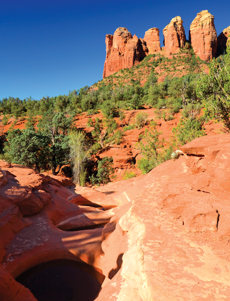
Seven Sacred Pools as seen on the Solider Pass Trail. Photo by Deb Weinkauff.
Soldier Pass Trail
The Soldier Pass Trail is a perfect day hike. One of the things that we adore most about West Sedona’s Soldier Pass Trail is that the trail kicks off with two major attractions: the Seven Sacred Pools and the Devil’s Kitchen Sinkhole. You’ll encounter the sinkhole, one of the largest natural sinkholes in the Sedona area, at the quarter-mile trail mark. Hike another quarter mile, and you’ll see the pools with iconic Coffee Pot Rock in the background. From here, hike to 1.25 mile mark and turn right. From there, you’ll quickly find yourself on a slickrock ledge in a box canyon. Walk across the ledge (cairns or small stacked rock formations may mark the trail in some places) and then turn right onto a well-traveled trail that can be steep, but is short at 0.2 miles. Rocks can dislodge. Mind your footing. At the end of this trail, you’ll see three impressive arches that make this detour a must-visit. From here, turn back and take a right when you’re on the main trail. Soldier Pass Trail ends when it intersects with the Brins Mesa Trail. Take in the breathtaking views of Sedona, the wilderness and the Mogollon Rim. Turn back the way you came for a hike that’s a total of 4.5 miles.
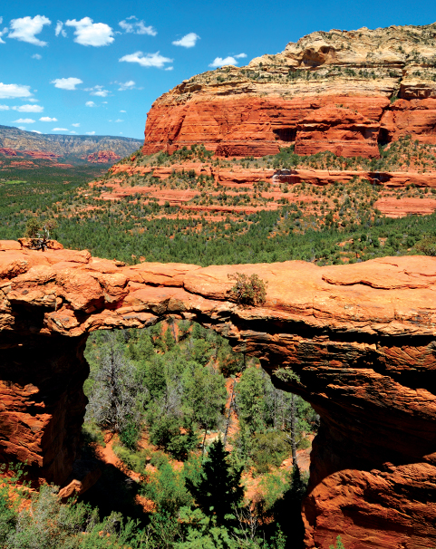
Devil’s Bridge, the largest sandstone arch in the Sedona area, that gives this popular West Sedona trail its name.
Devil’s Bridge
We wrote about this trail in our October issue. Read more about this hike at https://www.sedonamonthly.com/2021/devils-bridge-2
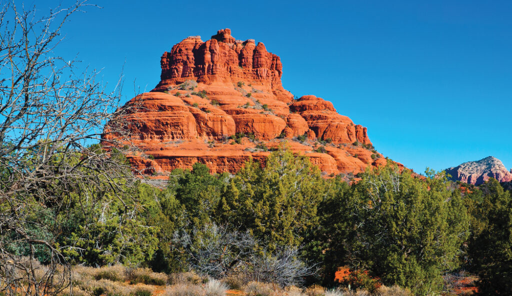
One of the most iconic red rock formations in all of Sedona, Bell Rock. One of the best ways to see Bell Rock up close is by hiking the Courthouse Butte Loop in the Village of Oak Creek.
Courthouse Butte Loop
For a round trip distance of just less than 4 miles, this easy-to-moderate hike is perhaps the best way to see some of the most iconic red rock formations in the Village of Oak Creek. If you hike this trail, you’ll get up close and personal to both Bell Rock and Courthouse Butte. Begin your hike at the trailhead at Bell Rock Boulevard. From here, you’ll spot Castle Rock, Bell Rock and Courthouse Butte. The trail intersects with Courthouse Butte Loop one-half mile into your hike. At about the halfway point, take in views of Courthouse Butte and Lee Mountain and stretch all the way to Capitol Butte, Cockscomb and Robbers Roost. One of our favorite side jaunts of this trail is Baby Bell. Near the end of your trail, take a right onto the Llama Trail and then a left onto Baby Bell Trail. Baby Bell is one of Sedona’s lesser-known gems that offers gorgeous vistas. From Baby Bell, follow the Bell Rock Trail and then the Bell Rock Access Trail until you reach the trailhead.
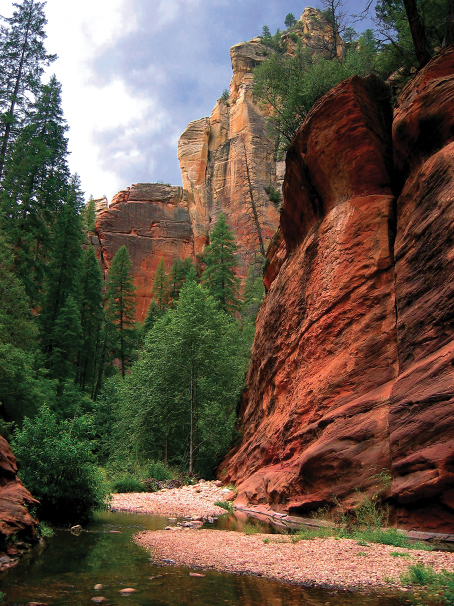
A classic and stunning scene that you can look forward to if you hike West Fork in Oak Creek Canyon. The green trees, babbling Oak Creek and towering sandstone formations all around you make for one serene setting. The entire West Fork trail is 14 miles long, but most day hikers turn around at the 3.3 mile mark.
West Fork
During the fall, West Fork is downright dreamy. Don’t get us wrong though: this trail is gorgeous year-round, but the fall season is when this Oak Creek Canyon hike truly shines. Look forward to a dazzling display of color with red and gold leaves, the water and vibrant red rocks towering above you. It’s quite the site. The trail kicks off at the Call of the Canyon Picnic Site. You’ll soon hike past the remnants of the Mayhew Lodge. This spot was a getaway for the likes of President Herbert Hoover and acting legends Clark Gable and Jimmy Stewart. As flat as this trail is, you’ll have to cross the creek in 13 places. The entire trail is actually 14 miles long, but that is one strenuous hike that requires wading, boulder hopping and swimming. Most hikers turn around at the 3.3-mile mark – the maintained trail ends here – for an out-and-back hike that’s just less than 7 miles long.
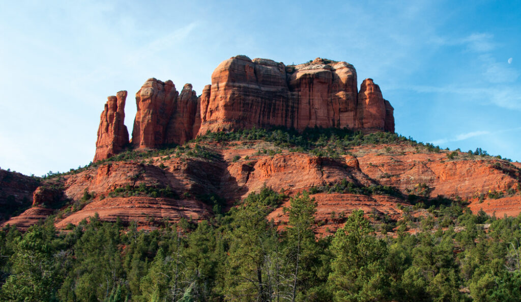
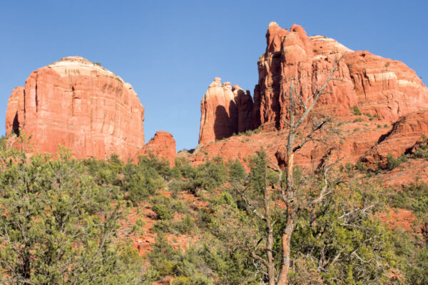
Cathedral Rock, the most photographed red rock in all of Sedona, stands tall. The Cathedral Rock hike is short, steep, and the views are stupendous. Photo by Deborah Lee Soltesz.
Cathedral Rock
This classic Village of Oak Creek hike is short at 1.2 miles long, but very strenuous. Be prepared to get on your hands and knees as you scramble up those red rocks. But oh, those red rocks. They are gorgeous here. Get up close and personal to them when you hike this trail that’s named after the most photographed red rock formation in all of Sedona. The trail begins with a steep ascent as soon you as you leave the parking lot on Back O’Beyond Road. At 0.22 mile, the Cathedral Rock Trail intersects with Templeton Trail. Follow the signs and stay left. You’ll quickly be scrambling until you reach the saddle at 0.68 miles. You’ll soon by rewarded with views of iconic red rock formations including Courthouse Butte, Bell Rock, Lee Mountain and the Rabbit Ears. Soak up those views, and then head back down for a hike that 1.2 miles total.
Please check with the Red Rock Ranger District of Coconino National Forest before planning your hike. For more information visit: https://www.fs.usda.gov/recarea/coconino/recarea/?recid=54892

